The Malga Caldenave refuge
Malga Caldenave refuge
Valcampelle Caldenave Forcella Ravetta
Audio Description of Caldenave Forcella Ravetta
Structure description
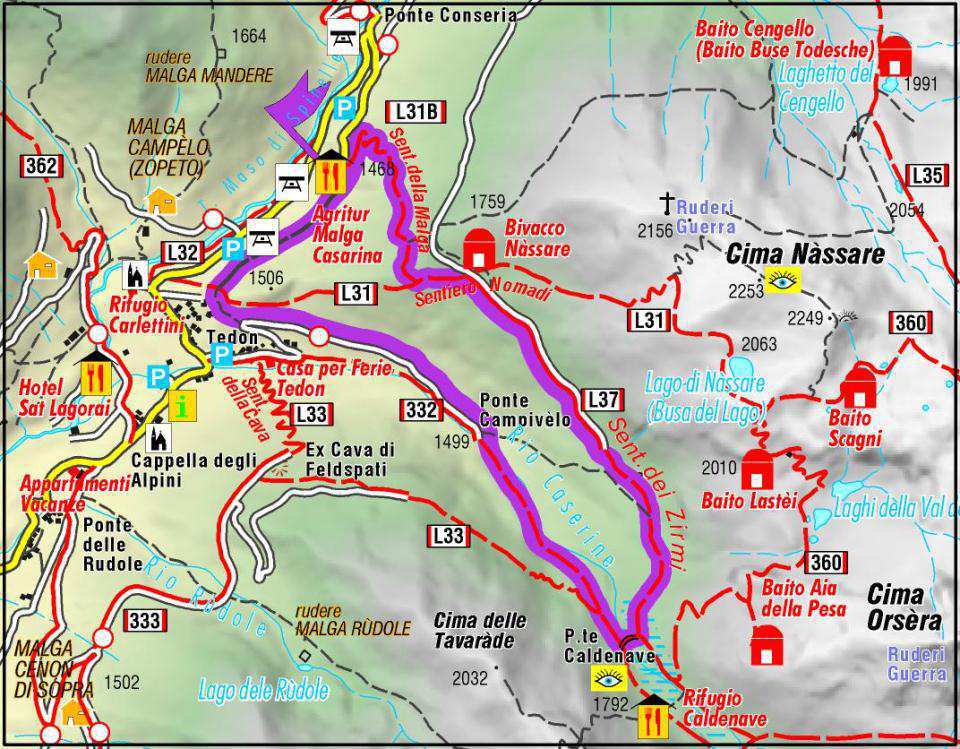
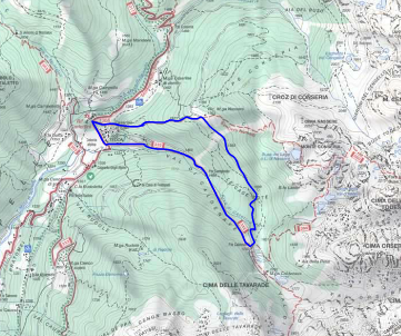
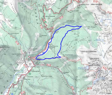
The Malga Caldenave Refuge is located in the Lagorai, in the granite subgroup of Cima d'Asta - Cime di Rava, in happy and ample position, which allows lovers of nature and environments of historical value (numerous testimonies of the First World War) to do More or less demanding excursions. Even those who simply love peace and tranquility will find here, without having to struggle much, the right place to regenerate, rest and enjoy a good dish of genuine cuisine. The nearby Val Orsra (40 min.) With the granite walls of Costabrunella, Cima Trento and Rava Creste offers different classic climbing routes and an equipped gym. Caldenave is a stage of the Alta del Granito. The refuge is open from late May to early October. The Malga Caldenave Refuge can be reached on foot starting from Val Campelle from Loc. Tedon (1350 m); Possibility of parking. Leaving the car you walk the SAT path nr. 332 which climbs into the woods and runs alongside the Rio Caserine. After an hour and twenty of easy path, you reach the anena full of caldenave and therefore the refuge that dominates from 1792. possibility of overnight and restaurant. Place of peace and tranquility. Starting point for excursions in the Lagorai, one of the two shelters together with that of C. D’Asta and Malga Sorgazza which are integrated by a splendid ring crossed "high via del granito.
Safe road to go down to the valley
Val Campelle itineraries
Excursions 1
Take advantage of the fantastic paths of the Val Campelle to walk, have fun and explore our valley. 10 different paths, from the simplest suitable for families, to the most demanding ones for enthusiasts and expert hikers, all perfectly reported. Each path is equipped for the maximum safety of hikers.
Excursions 2
From the square in Loc. Hotel at the Alpini Chapel, (1325 m), go along the paved road that continues towards the Consoria bridge. After crossing the bridge over the Rio Caldenave, take the road to the right with white - red signpost for Caldenave, Ravetta fork, lakes of the Val Inferno. Now the road becomes white going up to the first bend to the left. Here you take the comfortable mule track that continues by flanking the right bank of the Rio Caldenave-Casarine. White signs - Red Caldenave Forcella Ravetta. Before Loc. Campivelo, the path enters again on the forest road that ends at the Campivelo bridge. 45 '. (1499 m) The walkway on the Rio Caldenave is exceeded, the path begins to climb along the left orographic bank. After 1 hour you reach the Campivolo della Malga Caldenave. Once at the crossroads for Ravetta fork, it bends to the left for about 50 meters following the Sat signs for Val dell'Inferno thus reaching the Caldenave bridge. (1748 m).